File:SC Organized Counties.gif
SC_Organized_Counties.gif (480 × 380 pixels, file size: 207 KB, MIME type: image/gif, looped, 20 frames, 33 s)
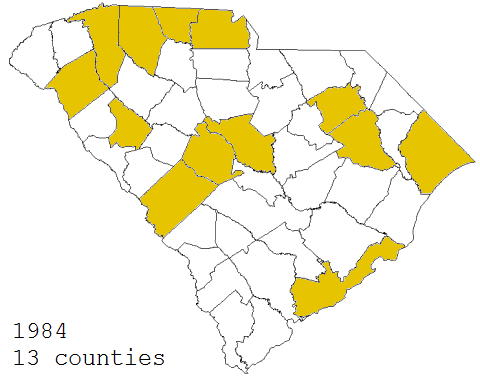
A map of the South Carolina counties with officially organized Libertarian Party affiliates from 1984 to the present.
The data used to create this map was pulled from a number of different sources of varying completeness and reliability, so its accuracy for all times and locations is not guaranteed. For example, the number of counties is said by older members of the party to have increased from 8 to 13 before decreasing back down to 7 during the large gap from 2006-2012, but no data have been recovered for that period to indicate which counties were organized and when.
File history
Click on a date/time to view the file as it appeared at that time.
| Date/Time | Thumbnail | Dimensions | User | Comment | |
|---|---|---|---|---|---|
| current | 07:49, 17 September 2018 | | 480 × 380 (207 KB) | SCLP Secretary (talk | contribs) | A map of the South Carolina counties with officially organized Libertarian Party affiliates from 1984 to the present |
You cannot overwrite this file.
File usage
The following page uses this file: